Twelve Tunnels To See In Seven Hours
Sure, you’ve driven to Washington County’s covered bridges – but what about the tunnels in the area? Washington County needed bridges and tunnels for the railroads that were built as the Industrial Revolution brought wealth and jobs to Washington County.
Consult the map below, which shows markers for each tunnel. Zooming in on the map – controls are on the upper left – can help locate the tunnels. Coordinates will be displayed when a marker is clicked or tapped. Some of these tunnels can be walked but many of them are closed.
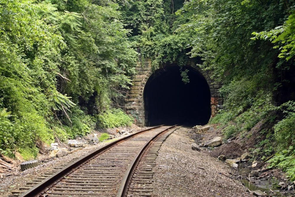
Start at the Brady Tunnel, which passes under a hillside near Washington Park. It’s open to railroad traffic and is used by the Allegheny Valley Railroad. Formerly part of the CSX and B&O systems, it is sometimes referred to as the B&O Brady Tunnel. The historic tunnel was built in the 19th century. A photo of the Brady Tunnel can be seen at the top of the article.
Continue west on the National Road until reaching the Fox Tunnel, or Tunnel No. 3, shortly after passing North Sunset Beach Road. Also called the Hempfield Tunnel, the Fox Tunnel is about 330 feet long with a bend.
The National Pike Trails Council in Claysville bought the right of way for Tunnel No. 3 and turned it into a Rails to Trails project. It is open to foot and bike traffic. It doesn’t have a hard surface. Bikers should use bikes with wider tires.
The council is working to create a continuous walking and biking trail from the PA/WV state line east into Washington’s 7th ward. They hope to open the completed trail to the public by 2030.
Related tunnels include:
- The West Alexander Tunnel, or Tunnel No. 2, runs underneath Liberty street in West Alexander. Tunnel No. 2 is closed because of a partial collapse on the west portal.
- The McClellan Tunnel, or Tunnel No. 4, is roughly 150 feet long. It passes underneath the National Road.
- The Taylorstown Tunnel, or Tunnel No. 5, is closed due to structural issues. There are plans for its renovation.
- The Finney Tunnel is located near the tresses in the Lincoln Hill patch town. The tunnel was heavily trafficked at the height of coal mines in the region. It was operated by the B&O Railroad and is called B&O Tunnel No. 6. The tunnel closed in the mid 1980s. While it’s listed as active out to Taylorstown Station, it is mothballed and heavily overgrown.
Tunnels 3, 4 and 5 are owned by the National Pike Trail Council. Tunnel 3 (the Fox Tunnel) and 4 (the McClellan Tunnel) are open to trail users.
To get to the Finney Tunnel after walking Tunnel 3, turn around and drive back to McKee Road. The Finney Tunnel is about 3½ miles west of Washington. Photos of the tunnel taken by Sherman Cahal in 2017 can be seen at Bridgehunter. Bridges and Tunnels also has a photo.
Drive north to Avella, a community in Independence Township, where three tunnels can be found – Stateline, Bixton and Craighead. All three are actively used by the Wheeling & Lake Erie Railroad and were formerly part of the Norfolk & Western, Pittsburgh & West Virginia Railway, Wabash Railroad and Wabash-Pittsburgh Terminal Railway systems.
Stateline Tunnel, also written as State Line Tunnel, is a 1400-foot railroad tunnel in Jefferson Township near the West Virginia Border. It runs underneath Penobscot Road. It was originally named the Klein Tunnel.
Buxton Tunnel is over 900 feet long. It was built a mile east of the West Virginia border in Independence Township.
Craighead Tunnel is an active, 1,100-foot tunnel located two miles east of the West Virginia border.
Travel east from Avella on State Route 50 towards Hickory, a community in Mt Pleasant Township, to see another three tunnels clustered together – McGugin, Hickory and Acheson. Those three tunnels are also used by the Wheeling & Lake Erie Railroad and used to be part of Norfolk & Western and Pittsburgh & West Virginia. Route 18 crosses Route 50 at Hickory. Route 519 starts at Hickory. That area could be a place to grab lunch.
McGugin Tunnel passes underneath State Route 18 in Hickory.
Hickory Tunnel lies underneath Main Street, which is the local name for State Route 50. A train emerging from the Hickory Tunnel, taken by Jason Capra in 2013 can be seen at Flickr.
Acheson Tunnel is an 800-foot-long tunnel that was originally named the Taggart Tunnel by the Wabash-Pittsburgh Terminal Railway. Both the names Acheson Tunnel and Taggert Tunnel can be seen on the portals of the tunnel.
Travel east on Route 50, turn right onto Cecil Henderson Road and continue towards Lawrence, a community in Cecil Township, to walk through Greer Tunnel, an old railroad tunnel that is now part of the Montour Trail for walking, hiking and biking.
Greer Tunnel was built over a century ago to service coal mines in the area. It is a short 235 feet long. The tracks were removed in the early 1980s. This stretch of the Montour trail was opened in 2008. Pictures of the tunnel can be seen at Foursquare.
The last two stops are near Monongahela.
Temple Tunnel, under Truman Road in Monongahela, is more than 700 feet long. It is part of the Wheeling & Lake Erie Railroad, and was part of Norfolk & Western and Pittsburgh & West Virginia.
Vang Tunnel is an abandoned tunnel located near the Monongahela Cemetery, giving rise to unconfirmed speculation that it may be haunted. There’s a waterfall nearby. The tunnel was built in the early 1930s and hasn’t been used for four decades. Several geocaches are nearby, but the one at the tunnel was ruined in a dirt slide.
That completes a day of tunnels to drive through or walk through, abandoned tunnels to look at and active railroad tunnels to see from a distance. Traveling to look at twelve tunnels in seven hours is an estimate. How much time the excursion will actually take depends on how long is spent on each tunnel stop, lunch and other breaks.
Locations of twelve tunnels in Washington County
This article was published in and updated in
