


Protecting The Washington County Frontier
Before the Revolutionary War, the British built forts near Washington to protect themselves as they moved west into land where Native Americans lived.
Immigrants from the British Isles and native-born people who lived along the eastern seaboard were going west for a better life on the frontier. In those years, the frontier was in this area, which was claimed by Pennsylvania and Virginia. The Native Americans who already lived here fought to protect their land and homes.
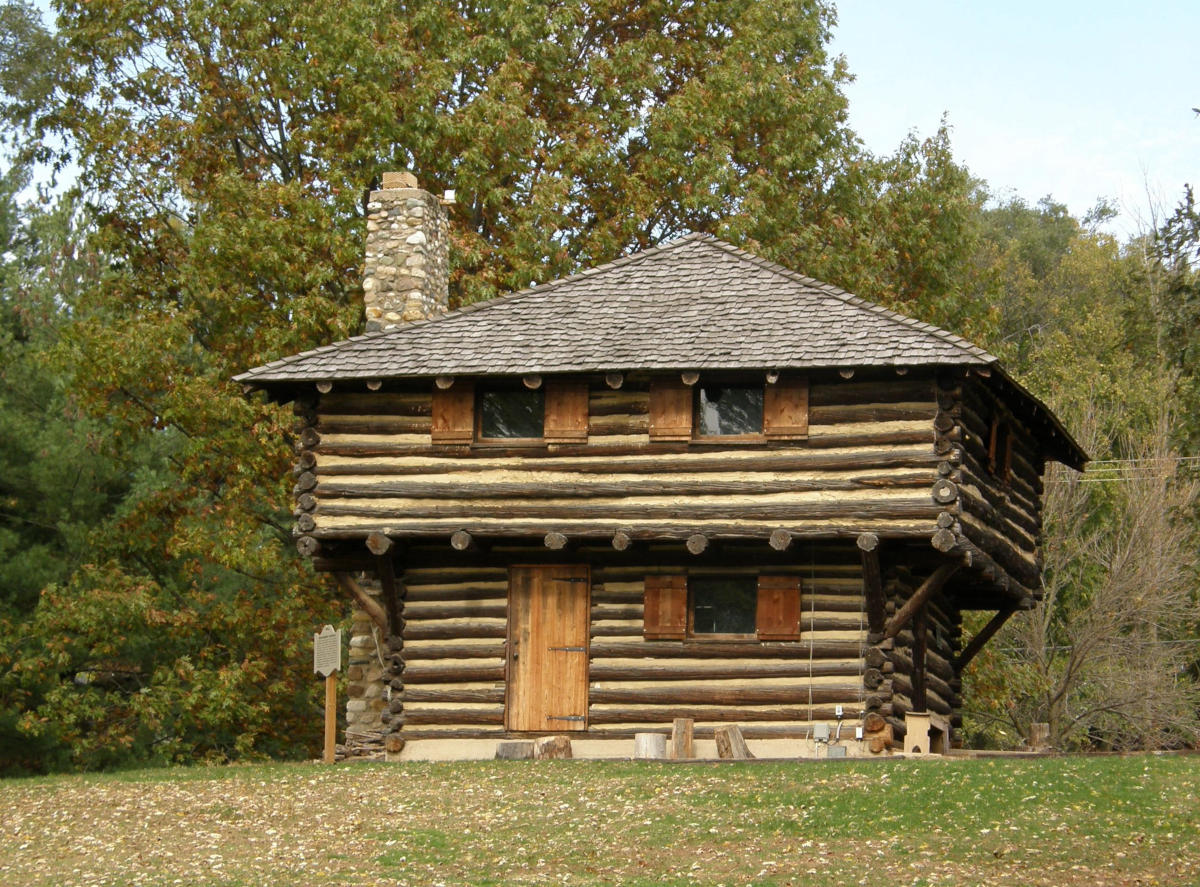
One strategy for the British in a dangerous, sparsely populated area was to erect many forts, blockhouses or stockaded log cabins to protect themselves from attacks. The forts were usually built above a creek.
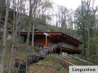
John Doddridge’s Blockhouse
John Doddridge’s Blockhouse, built in the early 1770s on a branch of Buffalo Creek, provided the West Middleton area’s community defense. The state militia was garrisoned at John Doddridge’s Blockhouse after the attack on Rice’s Blockhouse.
The blockhouse was a series of log cabins with a log wall built to harden the structure against attacks. The structure was durable – it could still be seen in the early 1900s. Following World War Two, the Pennsylvania Historical & Museum Commission put up an historical marker near the blockhouse showing its importance.
Lindley’s Fort
Tall logs with sharp heads were pounded into the ground in a tight square shape around Lindley’s Fort. At each corner was a blockhouse.
one of the strongest forts in the western country, because it most exposed to the hostile incursions of the savage inhabitants.
History of Washington County by Alfred Creigh (1870)
Lindley’s Fort was built in 1773 by twenty families who settled in what is now Morris Township.
Lamb’s Blockhouse
Lamb’s Blockhouse was built in 1774 to improve the defense of the area. It was located about four miles from Rice’s Fort in what is today Hopewell Township.
The first settlers were squatters who purchased the land from the native Indians for a gun, trinket, or gewgaw
History of Washington County by Alfred Creigh (1870)
John Cherry’s Fort
John Cherry’s Fort, built in 1774, consisted of three log cabins laid out in a triangle to make a stockade. One cabin was larger – it was two stories high and 25-feet square.
This minimal fort was located in the Cherry Valley in Mount Pleasant Township.
Major Gabriel Cox’s Fort
Major Gabriel Cox’s Fort was a stockaded post on Peters Creek a mile from Gastonville in what is Union Township today. It was built in 1774 and was active into the 1780s.
The Virginia militia was stationed there before Virginia gave up claims to the area following the Revolutionary War.
Revolutionary War Years
During the Revolutionary War (1775-1783), immigrants and native-born British or Americans – depending on whose side of the war they were on – moved westward, setting a migration pattern that would continue in America for more than a century. Right then, the local pattern was to move from the eastern seaboard through the Appalachians, stopping at Washington County.
In the late 1770s, Atkinson’s Fort was erected on North Fork Tenmile Creek, just northwest of Prosperity.
Miller’s Blockhouse
Jacob Miller, Sr., built a blockhouse around 1780 to protect people who moved into the Dutch Fork area of southwest Washington County from reprisals by Native Americans.
Two years later as the Revolutionary War raged along the eastern seaboard, the fort was attacked. Ann Hupp lead a spirited defense in an effort to convince the attackers that there were more defenders than they had.
After World War Two, the Pennsylvania Historical & Museum Commission installed a marker along U.S. 40 near Claysville to note the blockhouse’s importance. The blockhouse had been situated 3 miles north of the marker.
Wolff’s Fort
Wolff’s Fort was one of the most important forts in the area. It was basically a stockaded log cabin.
Like many of the colonial/Revolutionary War era forts, an historical marker was placed along U.S. Route 40 after World War Two.
Rice’s Blockhouse
In 1781, Washington County was created by the state legislature during the Revolutionary War. The same year, Abraham and Daniel Rice built a fort on the west bank of Dutch Fork Buffalo Creek twelve miles from the Ohio River. One side of the fort was made of cabins with dirt floors. It was protected by a stockade. Walls were ten or twelve feet tall. Blockhouses were set two feet outside the cabin walls and stockade.
The following year, Native Americans, British officers and Loyalists tried to storm Fort Henry, located on the Ohio River where Wheeling is today. They failed. Leaving Fort Henry, almost 100 Native American warriors turned east and attacked Rice’s Blockhouse.
The blockhouse was defended by six people.
The native people retreated.
The next morning, armed settlers pursued, gave up the hunt and returned.
A marker was put up by the Pennsylvania Historical & Museum Commission in 1973.
Closing
Dozens of forts were built in Washington County when this area was the American frontier. Few have been excavated. Little is known of them except a name, rough location and a range of years the forts existed.
The end of the Revolutionary War changed things. Restless citizens of the new democratic republic left the older, settled regions of the east behind to seek a better life. They continued to flow through the Appalachians but instead of stopping here they continued onto what is now Ohio, Indiana and Illinois, and the new forts were built there.
Frontier forts & blockhouses
This article was published in